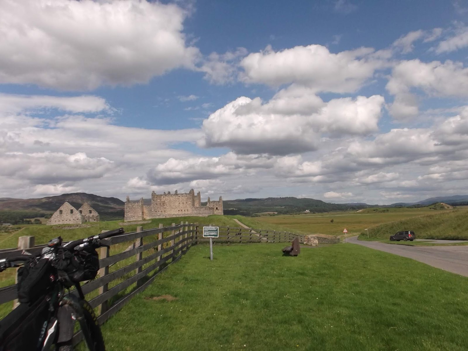
Every October the Clachaig inn, Glencoe holds its annual beer and music festival, the 'Octoberfest'. Me and various friends have been going to this pub off and on for many years; usually on motorbikes, either on the way elsewhere up north or just to sample the many ales it has on offer. In fact its the place where I first got drunk at the tender age of 16. We've been to Octoberfest a few times, generally staying in the bunkhouse just down from the pub. For various reasons we'd missed a couple of years and I'd not actually been to the Clachaig at all since 2012. So this year me and four friends decided to re-start our tradition of attendance, this time staying in a luxury caravan at the bunkhouse.
I'd included some kind of cycling in the proceedings in previous years in order to get an appetite for the many ales we always manage to drink. This year I had a notion to drive part way up and ride the rest of the way by some suitable route. I figured starting at Lagan just west of the A9 would allow me to do a large-ish route over the Corrieairyack, down the Great Glen Way, then the West Highland Way. I've done a lot of bike riding this year and this seemed a good way to round off the year before the winter kicked in and I'd be limited to day rides.
A further justification for this route was to check out the newly opened Great Glen Cycleway between Fort Augustus and Fort William. During this years Highland Trail campaign I'd noted signs of the old railway line being worked on and research afterward indicated that there was a project underway to create a cycleway the whole way from Inverness to Fort Bill; due for completion that summer. Part of this would be on the same line as the Great Glen Way and some of it would be new. I'd mentioned this to Alan Goldsmith in an email exchange over the day one route and he'd asked if I could recce it and get a gpx that he could include in the HT route.
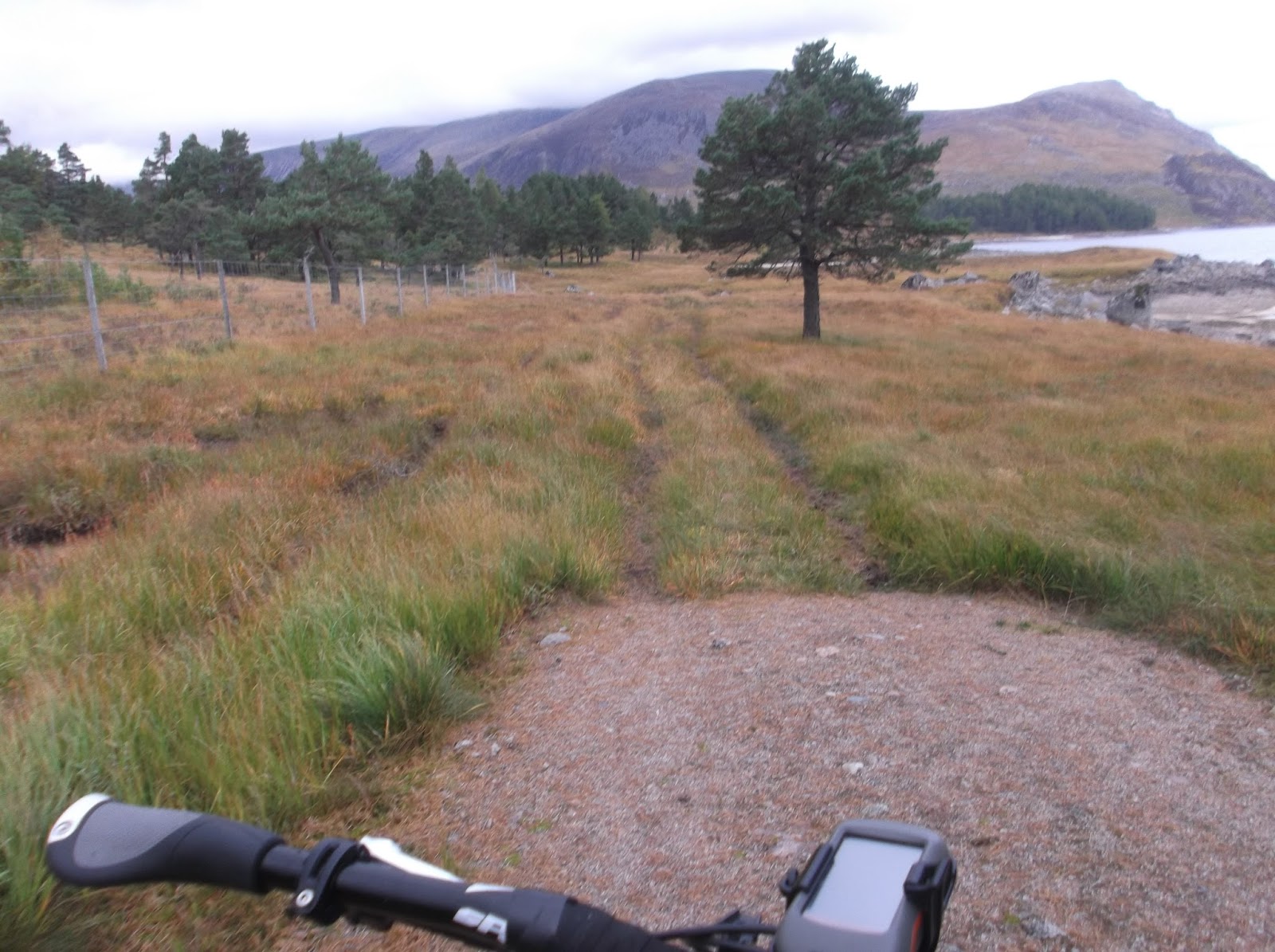
So I booked the Friday off work on the strength of a good weather forecast and left the house early doors to get an easy run up the A9 to Dalwhinnie and thence Lagan. The weather was cool and cloudy but with hints of the nice day to come. Better yet was a stiff North-Easterly breeze which would provide a tailwind for the whole route. After Lagan village the tarmac runs out at Melgarve Bothy which I had a brief nosy at before hitting the dirt.

On the first part of the climb I eyed up a large machine busy restoring the access track used to install the Beauly-Denny power line further up the hill. When this track was being put in they used Wades road as the initial access for plant and as a result did the whole route up to a good standard which finally seems to be standing the test of time. Previous excursions over the Corrieairyack had been a struggle due to the large boulder field and huge washouts masquerading as the track surface. Now its pretty smooth with only some monster water-bars interrupting the flow.
Hmm, the last time I was on this was during the Highland Trail. I seemed to be repeating lots of the route on my various bike trips this year. Not intentionally as such, I guess its just a function of it covering so much ground across Scotland. Any reasonable length of route in the Highlands is therefore bound to meet it. In fact the last time I was up here on the Krampus was on my ill-fated Highland Trail attempt in 2014. That day, despite my legs being totally wrecked, I'd got up the whole climb thanks mainly due to a 20/34 granny gear. Today I was on my 1x10 which was only a 30/42 granny but in the event I still got up - all thanks to my excellent form and fresh legs.

The top, still a bit grey but breaks in the cloud all around.

Looking west towards Strath Cannich, Kintail and Torridon
Being a Friday in October I had the place to myself. I hammered the descent and made sure I rode the bottom of the hydro scheme track instead of the 'official' wades road. The local landowner seems to get very annoyed at people doing this which is why I do it. Access rights of course as well as the fact that I buy my electricity from Scottish Hydro and they put the track in so in fact I'm riding on my track! The sun finally appeared right on cue as I rolled into Fort Augustus so I grabbed lots of pies and cakes from the shop and sat in the sun having a leisurely brunch. A passing tourist expressed gasps of amazement at the Kramps 3" wide tyres. Funny really these seem narrow to me nowadays....
So with a nice following breeze (for a very nice change along here), off I went down the Great Glen Cycleway. This actually has quite a checkered history. A previous incarnation pre-dates the Great Glen Way (which is touted primarily as a walking route although you can bike it) and followed some pretty steep trails thrown at the ground with little thought for durability or rideability. It also finished at Drumnadrochit and thereafter you either had to turn back or continue on the not too pleasant A82. After a few years it was showing signs of serious neglect, got little use and was therefore abandoned.... Some years later much funding was gained through Scottish Natural Heritage, Forestry Commission Scotland and Highland Council to develop the Great Glen Way as an easy long distance walking route. This used most of what had been the old cycling route - the Caledonian Canal tow path , various forest tracks and sections of either the old General Wade Road or disused railway line which goes through here but also built several new sections, in particular along the length of Loch Ness above the A82. Then this year the Council started to re-develop the cycle route. This uses the quiet roads on the south side of Loch Ness, the easier bits of the Great Glen Way and a long length of disused railway alongside loch Oich. Confused?
Whatever it was an easy pedal in warm sunshine with great views down the glen. Right enough the section alongside Loch Oich was all on the old railway line. This has been closed since the 50's and mostly impassable. I'd ridden along here in 2014 as part of a tour and one section was a mass of tree routes which made for incredibly hard going. Wades road and the HT route parallels the railway line for much of this so on my 2015 ride we'd been duty bound to follow the proper route along wades road which, as per the rest of the HT route was very wet. Then the cycleway was incomplete but the roots were no more! Now its a great route with a smooth dust surface. You pass through a couple of rock cuttings and a tunnel and its pan flat the whole way. I guess the only problem is that Wades road will likely not get used any more and therefore become totally overgrown. After Loch Oich your on a nice single track section which had only been re-surfaced, not widened. Then it was up into the forestry beside Loch Lochy, views of Annoch Mor and Ben Nevis building to the south.

The last time I'd been on the final section of towpath (now also re-surfaced and billiard table smooth) it had been 9.30pm, I'd been going for 16 hours and it was pishing down. Today it was warm, sunny and I was cruising effortlessly. At Fort William I sat in the afternoon sun eating more pie and cake contemplating my onward route. The easy way would be to just horse it down the A82 to Corran and thence the cycleway to Glencoe village. The A82 is not particularly nice on this section so definitely worth a miss. That left the West Highland Way, last done in more torrential rain and an ungodly 6 am on my last day of the HT. Today it was warm, dry and I was feeling super strong so left without a thought. I couldn't be bothered with the WHW out of Glen Nevis however so short-cutted up Wades road (tarmac) before picking the WHW and HT route near the road end.

The climb up the Lairig Mor seemed to take no time and soon enough I was clattering down the rough descent into Kinlochleven as dusk fell. Then it was case of following the bumpy twisty B863 out to Glencoe village and up to the caravan, some 80 miles and eight and a half hours after leaving the car. My pals were already ensconced and champing at the bit to go to the pub!
This we did and had a fine night drinking many ales and eating food whilst listening to the usual folk band. Walking back from the pub it was raining. This was forecast for most of the night but was due to be off by the next morning.
We woke to a steady drizzle, somewhat late thanks to the previous nights festivities. After a leisurely breakfast we all headed out. They (Dawn, Ron, Jim and Kim) were out to bag some waterfalls above Kinlochleven. I was also heading there but I had bigger fish to fry - the Chiarain Path. As I passed through the woods above Glencoe village the sky brightened and the sun came out on the road to KLL. Thence it was 'that' climb up past the water pipes (again!) but at the penstock, instead of turning off up the WHW, I kept on a ways before dropping onto the lid of the aqueduct. This is a 3m square concrete box through which water flows from the Blackwater reservoir to feed the power station at Kinlochleven, formerly the Aluminium smelter. Its nigh on level (well it climbs at about 1:100) and fast. The only dodgy bits are where it crosses gorges on viaducts of various lengths. There are no handrails of course so these can be a little unnerving if you don't have a head for heights.
Finally reaching the dam I picked my way across the vast area of rock that used to be a raging river before it was dammed. Now its barely a trickle and with a bit of nose following its easy to pick a route across. In fact this area gets used for the Scottish Six Days Trial for a number of sections so there are wee trails everywhere. At the far side of the dam you follow another pipeline (a round one this time) which links the Blackwater Res to Loch an Eilde Mor. All part of the same hydro scheme. After only a couple of hundred meters you turn away from this and start one of the UK's gnarliest descents - the Chiarain Path.


Its typical of the breed and quite eroded due to being used by the SSDT so rough as in places with some steep sections and plenty of drops. I'd last rode this on my Orange 5 in 2011, also on an October Fest weekend. I'd blasted down it in about 30 minutes and was left feeling somewhat underwhelmed by the experience. This marked the end of my full suspension biking career in the event. So here I was on a rigid steel bike eagerly anticipating the battering I was about to receive. Now as it happens I had an action cam (a Garmin virb) attached to my bars and I hoped to get some good footage of the descent. Off I went clattering across everything in my path. I rode pretty much all that I remembered having ridden previously excepting one particularly precipitous drop. I felt I was making good progress and the 29+ was going through everything. The clock told a different story as it took nearly twice as long.
That said this included a rather epic burn crossing. As I'd ridden along the aqueduct, I'd noted a few of the side burns on the opposite side of the glen looking somewhat tumultuous due to the previous nights rain. One in particular looked to be a raging torrent. Sure enough when I arrived it was fierce. My riding this year has been characterised by several epic river crossings, mainly on the Highland Trail but with a few others also adding to the drama. This one looked like it could be the worst of the lot. I'd been following fresh tyre tracks however so someone else must have got across and I figured it would go. First attempt nearly had me over as I sank up to my thigh into a strong current which also caught the bike wheel. Oops best try elsewhere....
A bit further downstream the flow widened somewhat and so was much shallower. I stepped carefully across feeling my footing with a deal of care as there was a waterfall right behind me.... Phew made it. I stopped to drain my boots and then carried on knowing another river was coming. I passed an elderly couple soon after who advised it was fine. I told them not to attempt the crossing I'd just done!
Sure enough the next river, despite being in a huge gorge containing a wreck of a bridge, was barely a trickle. Odd. The remainder of the route passed without incident and I rolled back to Glencoe along the road with a big grin on my face. Afterward I reviewed the camera footage and it was truly painful. What had seemed to me to be a progressive descent down the trail was revealed as continual series of fits and starts that made for turgid viewing. Worse, as the camera was bolted to the bike it was bouncing and shaking all over the place and actually made me feel physically sick watching it. I'll not be doing that again.....
That night involved more beer, food, beer, folk music and beer. The pub was rammed so we'd ended up in the back bar. This did make for easy conversation and you could still hear the music. Thankfully the clocks would be changing that night so we'd get an extra hour in bed.
Sunday dawned sunny but we had to be up and out of the van by 10. We had a large breakfast in the Glencoe cafe and then once again I was cycling along in pleasant sunshine with a tailwind thanks to the wind shifting back to the south west. My route back would involve picking up some forestry trails from Onich in the hope that I would miss out a large chunk of the A82. From Glencoe to Onich is now off road as they have widened the footway into a cycleway of sorts.
The track out of Onich was good and the bridge over the Abhainn Righ was in fact there! I then picked my way above Inshree following a mix of fire roads and walking trails. Hmm. the forest road shown on the map seemed to have disappeared under a load of clear fell. I had that familiar sinking feeling and back tracked to try another track lower down. What was on the ground didn't seem to bear much resemblance to what was on the map but after a bit of nose following, one struggle down a track covered in brash and a careful crossing of a river over which there wasn't a bridge that was marked on the map, I joined the A82 for the final few miles into Fort Bill.
I rode straight through and sought out the cycleway which goes from the edge of the town to the ski centre. This is a roadside path for a while but you turn off at Torlundy past the North Face (of Ben Nevis) car park and head into the woods, part of the waymarked trails in Leanachan forest. Sections were taped off and showed evidence of much use. Arriving at the ski centre it was crowded with very muddy (and wasted looking) people attaching very muddy bikes to cars. Turns out it was the 'Sleepless in the Saddle' 24 hour race which had finished at 10 am that morning. I parked up outside the cafe and queued for a while to grab a large lunch which I ate sat out in the sun, contemplating my onward route.
The plan was to ride through the forest towards Spean Bridge, then pick up the East Highland Way which I'd ridden with my pal Iona a couple of years previously and on which I'd broken my collar bone. By this time the weather was glorious so I pedaled steadily through the woods taking in the views all around. From Killieconate you join the EHW on a back road at the end of which a group of squadies were congregated around a truck immovably stuck in the roadside ditch. You often see the Army around here, the vast area of mountains to the east an obvious draw for training purposes. I gave them a cheery wave and carried on to Insh farm. After this it gets progressively rougher to Monessie farm - a strange place in that it has no good track access and a large river between it and the main road. There is a ford across this but impassable when the river is in spate. The EHW follows a vaguer line (well marked) through fields by the river, down a bank and across a side burn into felled woodland.

Its a good route and was created by a guy off his own back as a way to link the West Highland Way to the Speyside Way. As I headed through the forest to Fersit and beyond I contemplated the land to my right. This is one of the biggest wilderness areas in the country (in fact the whole of Europe) only beaten by the Caringorms as this area has a few isolated lodges and the West Highland Railway line passing through it. Various routes through it can be followed by bike although its quite an undertaking. The Highland Trail route came through here but its first day route is changing and will head through further to the east. This is a bit of a shame as the old route has a section of nigh on 50 miles between public roads. There are a couple of rubbish bits however and the new route uses much nicer trails....

Dusk was now falling as I progressed north east. I took collarbone corner at a suitably low speed and then climbed up to Loch an Earba rather than the easier route along loch Lagan, keen to re-visit as much of the HT route as possible.


Darkness eventually fell as I passed Ardvericke, thanks to the clocks going back, but soon enough I was back at Lagan, some 67 miles and six and a half hours since starting. That's it for trips for me this year. I'll do plenty of day rides of course and look forward to (hopefully) another snowy winter!
It was early September and for a change the weather was nice. Id actually gone on a rare (for this year) ride on the motorbike up to Rannoch station, one of my favourite roads. As I sat a hundred metres along the track to Loch Laidon, drinking tea and looking at the view west to Glen Coe, a train came in and it crossed my mind that I'd never been on the West Highland line. Its special - after Bridge of Orchy it strikes north away from the A82 across Rannoch Moor. Beyond Rannoch station it cuts a cross a swathe of fabulous scenery, briefly touching civilisation at Loch Ossian before the long descent past Loch treig to the A86 at Fersit.
I'd encountered this line on a few occasions doing various bike trips and it fascinated me to see the smooth level rails heading across country at gradients no steeper than 1:50, despite the precipitous landscape. The building of it was an epic tale of engineering and its a testament to its design that its still intact today.
Two weeks later and I was on the train out of Glasgow Queen Street, destination, Fort William, loaded fargo in the bike racks. Typical. The train was rammed and a large number of people on it were a bunch of Glaswegians off to Ossian Station to climb one of the party's final Munro. So much for a quiet contemplation of the scenery on my way north and west. They were already noisily drunk even before they started so god knows what they must have been like by the time they'd finished.
The weather was good but patches of mist were a plenty so views were a bit hit and miss. The line the railway threads to Crianlarich is tortuous, passing as it does through many steep sided glens (including past the atrocity that is Faslane). Beyond Crianlarich the now split train was even more crowded as more of the munroe baggers joined it. Still I enjoyed the run north, spying the road to the isles and the Highland Trail route out of the Abhain Rath and up past Loch Ossian. After Ossian the train was quiet so I relaxed for the final miles to Fort Bill.
Timing was tight - I wanted to catch the wee ferry from Fort Bill to Camusnagaul to avoid an A road schlep. I made it with minutes to spare and the boat chugged across the short crossing, the fargo strapped somewhat precariously to the cabin roof.
Finally I was pedalling. My route took me west and did include a short section of the A830 before turning off down the long track by Loch Shiel. This is a beaut of a route - nice and smooth and super scenic. Low cloud made the scenery more dramatic and I took it very easy to appreciate it.

Loch Shiel track
You leave the Lochside and join the public road again at Polloch. I did consider heading up to Resourie bothy but it was too early so ground up the substantial road climb over to Strontian. The cafe in Strontian was a nice break and I languished until they turfed me out at 5. Thereafter it was some pleasant road bashing round by Loch Sunart to Salen. From here there is a short climb and descent to rejoin the last of Loch Shiel. The weather was starting to close in so I decided to keep onto Glenuig and see if the hostel had beds.
The pub at Glenuig has seen many a visitation by myself over the years, generally on a motorbike. I first came here on a family holiday in the '80's where we stayed in a croft a mile or so past the pub. It was my first experience of west coast pubs that never shut, west highland scenery and midges....
Since then I've generally camped close to the pub which is an unofficial but accepted campsite, the nearby village hall providing toilets and showers. A brief inquiry at the bar revealed plenty of bed space on a Sunday eve so I unpacked, drank tea and ate food until joined by a couple of blokes I'd passed earlier who were also staying. I ended up spending a few pleasant hours in the bar chatting to them - they were both folk musicians so we had enough in common (I play classical but its all live music) for it to be a lively discussion fueled by several fine ales.

Glenuig beach and Samallaman island. On my two family holidays we spent many hours here
The next morning dawned grey and wet justifying my cop out into the bunkhouse but by the time I'd breakfasted in the bar and packed up it had stopped. There seemed to be nobody about as I cruised around the road to Lochailort.
Back on the A830 again. This used to be single track but it was upgraded throughout the '80s and 90's until its all two way. Unfortunately this makes for hard pedaling as its all steady but long climbs up and down instead of the previous windy low level route. They have had a go at putting in bits of footway / cycleway here and there but mostly your on the main road. That said there was little traffic and after a few miles I turned off hoping to find a trail marked on the map which would be a pleasant alternative into Arisaig.

It took a couple of goes to find but soon I was following a pleasant track down by a burn across some fields and into the back end of Arisaig. I guess this must have been an early incarnation of the main road but it showed little evidence of use. Arisaig is a changed place. The main road used to go through it but its now totally bypassed. Its the usual dilemma - you remove the traffic but also remove the passing trade and given that most people will be heading for the ferry, I doubt that many will turn off route to visit this fine place. And it shows, its all a bit run down and forgotten but at least there was a cafe which provided rolls and coffee.
The run to Mallaig is actually good. The old road is deserted and very scenic. At Morar you go under the new road viaduct and round the head of the loch. Eventually your back to the main road again but a cycleway has been provided all the way to Mallaig. I hadn't looked at a ferry timetable but I knew the service to Armadale was reasonably regular so I was happy to wing it. In the event I had an hour or so to kill so headed for a bar for a beer and more food.
The boat was a new one and not the usual ship but more like the ferries that do the short crossings i.e. it didn't look capable of standing much in the way of high seas.... In the event the crossing was smooth and I spent most of it staring into Knoydart and thinking: "One day..."

Armadale to Broadford also used to be single track but this too was done up in the '00's to another smooth and wide two way. Its pleasant enough and after the ferry traffic cleared, also deserted, making its improvement somewhat pointless. For the sake of it I hopped over the verge onto a couple of the old sections that are still in existence and once again speculated on the ease at which a network of cycleways could be provided across Scotland which would make touring around so much nicer. Well easy apart from a few million but given the Scottish Governments determination to blow 20 bill on dualling the A9, this seems to be small change for a big benefit, if only they could see it.
I missed out Broadford for more empty A road to the Kyle of Lochalsh. The last time I'd been here by bicycle was 1990 after an arduous trek from Glen Garry to Kinloch Hourn and over a great trail to Arnisdale and the road to Rattagan. We were traveling light so Rattagan hostel was to be a stop over but unfortunately we hadn't booked and it was full hence the need to schlep all the way to the Kyle in order to find digs. I had some more cafe culture here and chatted to a couple of bikers on old air cooled BMW's who were doing the Scotland thing. I'd been on the cusp of several rain clouds up to this point and had been rained on a few times but finally the sun came out and very nice it was too, sitting outside drinking tea, eating cake and watching the scenery.
My route planning for this trip had been fairly vague. I'd a few ideas, an encyclopedic knowledge of Scotland's roads and trails and a few days to kill. I'd thought of doing Skye but on road involves more trunk road bashing so this didn't appeal. Plan B was to try and hit the far northwest but the weather forecast was crap so this seemed a bit too much of a mission. In the event I figured I could head to Ullapool the next day and see what transpired.
So from the Kyle it was round the coast to Plockton via some great wee roads. From just after Plockton your back on the main road but this is still single track and largely empty. Passing the Strathcarron Hotel brought back memories of my stay here in May on the Highland Trail, one of the dirty half dozen who stopped here to recover from the epic of Fisherfield and Torridon. I reversed the HT route to Achnasheen but the fargo dictated an easier route over the hills to Kinlochewe. The Coulin Pass is another route I've wanted to do so this was a perfect opportunity. A steady but smooth climb took me up to the pass and then it was a long descent into Coulin Forest. This is a wee bit rough for the Fargo on skinny Schwalbe thunderburts but once at the bottom the track improves. Tick! Another good route and I always feel smug when I avoid a long section of A road by doing such a track. Cycle Tourers take note! Get some 40mm tyres and start looking out these estate tracks.

Top of the Coulin pass, Liatach in the distance
On arrival at Kinlochewe the midges descended. This place is a particular hotspot for them and after a few midge free days thanks to a stiff breeze they appeared in force. I ran into the pub and was relieved to be told they had space in the bunkhouse. I got in and unpacked then headed barwards for food and beer. People will tell you that midges avoid the indoors for a host of entirely spurious reasons. The Kinlochewe hotel obviously didn't count as I saw several and even got thoroughly bitten by one of the wee sleakit bastards. Beer helped as did the fine food. I retired to the slightly scuzzy bunkhouse and crashed after what had been a long day.
Hmm. I woke to the knowledge that I'd been further bitten in the night in the Bunkhouse. My fellow dossers were still out cold so I quietly grabbed my stuff and headed for the Kitchen. It was raining steadily as I exited and the midges had taken shelter in the shed where my bike as. I had to spend a few seconds attaching some stuff, run out into the rain to escape them and then head in again to attach more stuff. Eventually it was done and it was a blessed relief to jump on the bike and pedal off.
It lasted most of the way up Loch Maree but eventually eased off on the climb past Slattadale. More HT memories... The descent to Gairloch was a hoot, I overtook a car at one point, that's how good it was! For a change I went straight through Gairloch as I had plenty of food and energy. The road climbs a fair bit after here and then descends to Poolewe. The HT did seem like a distant memory but passing through here I recalled my meeting with Ricky Cotter, going into the shop (and the loo) and the relief at exiting Fisherfield. And the rain which was torrential but today the sun was now shining.
The coast road from Poolewe to Ledmore is a cracker, particularly if you are on a motorcycle. Even on a bike its good - lots of ups and downs to be sure but this adds to the fun and the scenery is just fantastic. I was pushing on along here for no other reason than I can. As I approached the Corrieshellach gorge I decided to take a punt on another go at the short cut I'd tried on my August trip coming from the other side.
Then I'd tried to find a footbridge but it was knackered. This time I was on a hot tip that the river was crossable just downstream. I turned off the road on the track to the new hydro electric power station and descended steeply thinking that this would be a schlep back up. The track ended at a locked gate entering the power station building. A new and pointless fence had been put up between this and the river which was about 20 feet away and by the look a goer. I hoicked the bike over the fence and jumped after it. The river was a cinch and on the other side there was actually an obvious path up to the track I'd arrived at in August. Ha! another route found, another A road missed out and a big shortcut to boot. Hmm would Alan consider this as an alternative to the HT route over the Coffin Road? No chance given the fence crossing but if I ever found myself here again this would be the way I would go.
In Ullapool I had a dilemma - what now? It was only 4pm so plenty of riding time left but I'd done 75 miles already. I had fish and chips and a beer to help me decide. I could push onto Lochinver or head east to Knockdamph Bothy or...... Wimped out again. The YH had rooms so I booked in.
Hmmm. Big mistake. It was busy, despite it being mid week outwith school holidays, and to be honest I can't be doing with dorms anymore. I went to the pub to check out the weather and the beer and then turned in late. As per, everybody else in the dorm dropped off before me and snored their heads off. I'd dragged my tent around with me for 3 days so far and not used it. Why hadn't I pitched up at the Loch Broom campsite as per my August trip?? Too late now and ear plugs helped me sleep.
At breakfast I spoke to a fellow cyclist who was aiming for Durness that day, but by the direct route. I mentioned the crap weather forecast but she had a set itinerary she wanted to stick to. Fair play but my own casual approach to route planning seemed a better bet in the face of variable weather. Plus the A836 is a peach on a motorcycle but a grind on a bicycle. My own plan was to head to Lochinver via the Inverkirkaig Road and then take it from there depending on the weather.
The few miles of A836 to the Achiltibuie turn off convinced me that this was a good plan. This wee road is more cycling perfection. The weather was not, finally driving me into my waterproofs. That said as I turned off to Inverkirkaig it showed signs of clearing up but as per it didn't. Who cares, this road is an absolute belter albeit with a lot of climbing. At one point its the sea, the road and a cliff. A camper van that I'd let passed earlier was having a mexican stand off with another glaikit tourist who couldn't cope with such narrowness so I blasted through the lot of them with a huge grin. Of course I had to block the campervan all the way up the next climb knowing that I'd leave him for dead on the next descent. I did and never saw it again.
Rolling into Lochinver the weather had now deteriorated to hard, horizontal dreich i.e exactly like it had been in May. I went into the bunkhouse cum cafe and contemplated my options over soup, sandwich, cake, coffee and a huge bill. The journey north seemed a bit much if this was to persist (it was according to the forecast). As usual East looked far better so the decision was made. It would be a far nicer route in any case, with a tailwind and the prospect of better weather in the east.
I left in the rain, slightly disappointed that I wouldn't get to meet up with the lassy I'd spoken to that morning in Durness and get to regale her with tales of the hard way up north but as usual my common sense out-voted my hormones. Its a nice route east from here but the low cloud removed all views. At Ledmore I noted the exit of the Suilven path thinking that the weather had been equally as horrible in May as now. Still the road to Oykel Bridge was an easy pedal with a stiff tailwind and lifting cloud.
The Oykel bridge hotel was full of fishing types so I kept going to Rosehall and then the back road to Ardguy, thinking I'd stop in the cafe there. Waterproofs off and even a faint hint of sunshine down another wee road but Ardguy was a disappointment. The cafe which was new in 2010 was now shut. No shop, no nothing. The price of a small town not quite on the tourist trail. Next up the Struie road and a famous climb for roadies hereabouts. Last time I was here it pished it down so it was nice for it to be dryish today. Dryish. Not dry. Better than earlier but knowledge that the campsite at Evanton also had a bunkhouse settled into my mind in full prep for another cop out.
Bunkhouse life - you always meet people stranger than you, and for me that's no mean feat. This time a bunch of blokes from Wolverhampton up for hill walking who left just after I arrived to go to see an Inverness Cally Thistle game on the basis that they had to see the local team play whilst they were up here. Die hard footy fans, fair play. For me it was a trip to the co-op, buy lots and lots of food and beer. Sit in watching crap TV and eat and drink whilst my kit dried out in front of an electric fire. I'd done 110 miles today so I felt I'd earned it.
I had a very long lie the next morning, nigh on 'till 10, the supposed departure time. The others had re-appeared and departed during my sleep so I had breakfast in peace whilst plotting my days route. Aviemore and my friends place was an option but I felt I had to give the weather one last try. NCN 1 along the Moray Coast seemed worth a go and I figured Findhorn campsite would be a good destination as I'd stayed there a couple of years previously and there was two good pubs in the place.
At Inverness I called in at the Velocity cafe again as it had started to rain just as I passed along the High Street. So much for the forecast but this was old news now. The route east is a bit fiddly but its pretty good with some off road cycleway and some pleasant back roads.

Railway viaduct on NCN 1
From Nairn I left the NCN and headed into Culbin forest. This is fat bike world as there are loads of sandy trails as well as a big long beach. The fargo required me to stick to the forest roads but its nice - lots of well spaced out pine and fir rather than the mandatory dense sitka. The rain was coming and going but as I turned south to rejoin NCN 1 the cloud cleared back to reveal a surprisingly blue sky.
Findhorn is a thoroughly weird place. On the face of its a typical Moray coastal village with a a couple of good pubs, a chippy, a shop, a caravan and camping site and a hippy commune. Errr yeah, thats right. Its origins are allegedly the nearby RAF base, much like the camp near to Faslane. But I don't actually believe this as I think a more likely reason is the generally good weather and an opportunity based on dubious land ownership and a bunch of folk squatting on it. Nowadays there are a few old timers but mainly its modern hippies - i.e super rich - living in so called eco homes and a bizarre analogy of a 'green' lifestyle. All the houses have driveways and they are all full of range rovers, bmws and other bourge barges. Enough said.
In theory I should have been welcomed as a hero given my arrival by bicycle but the lady in the cafe typified the spirit of place by telling me 'we're closed' as I entered. Fuck them, I'd done more to 'save the planet' in my last 15 years of employment than the whole lot of them would achieve in a life time. So I hightailed it to the campsite feeling suitably self righteous, pitched my tent and headed for the boozer, plans to get thoroughly pissed and then stagger round the commune shouting abuse in the forefront of my mind.

A camp, finally
In the event I had a fine fish tea, a few beers and a wander along the beach.

The next morning was dry and fine but I figured a further jaunt east was taking me too far away from home, which I technically need to get to over the next three days. So I headed south to Forres and then picked up a quiet B road climbing steadily into the foothills of the Cairngorms. A turn off took me to Dallas and the land of whisky. I'd not been in this part of Speyside for many years and very fine it is too. Overall its pleasant rolling countryside but there is that edgy feeling that this is just a precursor to the main massif with occasional high hills poking above the surrounding wooded slopes to indicate the monsters to the south.
I dropped down to Knockando (another distillery) and then onto the Speyside way. For some reason I had it in my head that this would be a nice smooth gravel path but actually its fairly unmade, despite being a disused railway line, and therefore quite muddy after the rain of the previous months. Still, its better than the A95 which I only had to follow for a mile after leaving the SSW at Cragganmore (another distillery) but this was long enough to not want to ride on it any further. From here it was a long, long climb up to Tomintoul but no traffic, fine views, tailwind, warmth and dryness made it a joy.
As usual I stopped in the Fire station cafe at Tomintoul for lunch and dropped a text to my Aviemore pals to warn them I was incoming. The Glen Brown route is maybe a bit much for the Fargo so I opted for the famously hilly A939 and the back road to Nethy Bridge.
So it proved although the rain came back in at Nethy Bridge which nearly made me head for the road but in the event I dug in and climbed up and over the Ryvoan pass. As usual I called into the Glen More cafe bar for a couple of pints of Tradewinds and then hammered down the old logging route to Aviemore.
After a nice social evening I was up fairly sharp (9.30) with a vague plan to head south down the A9 corridor, then turn off into Perthshire, Loch Rannoch and home over two days. Heading South the weather seemed a lot less promising than what was forecast as per the whole of this year to date. Rather than stick to the cycle route I rode the military road from Ruthen barracks bypassing Kingussie and Newtonmore. Its a bit rough for the fargo in places but otherwise a great route and fairly direct. I rejoined NCN 7 at Etteridge, after hopping over the A9 crash barriers, and the rain came in again, in the familiar horizontal dreich of so many days out this year.
At least I had a tailwind as I hooned it down the A9 cycleway, only interrupted by several punctures / resealing that seemed to have plagued me over the preceding day. I'm new to tubeless having long since eschewed it given how much faff it is. Some very inconvenient thorn punctures and re-assurances from several tubeless old hands convinced me to give it a go. This had been 100% successful on the 29+ and fat bike but the higher pressure (and somewhat weedy) tyres on the fargo didn't like it. It started on the cycleway to Findhorn - a hiss, a spray of sealant and much fiddling to get it to seal. Not what I had been told should happen. Sharp stones were penetrating the thin tyre casing and where a tube would have shrugged them off, the tubeless wasn't and worse the sealant also wasn't. At the turn off for Loch Garry the weather closed in once again and any thought of another night out exited my mind. Home beckoned. I had plenty of time and a tailwind. Bash on.
At Blair Atholl I gave up fiddling and put a tube in. What a mess and faff.... Still I had tyre pressure, it was 1pm and I had about 80 easy miles to go....

There is not much else to report. I stuck to NCN 7 and 77, which is mostly on road, as far as Perth then headed over the hill to Bridge of Earn. Thereafter I followed an oft used back road route to home at 8.30pm, 120 miles and 10 hours after I'd started. Total distance for the tour, 600 miles.
Bike touring is supposed to be relaxing, you don't have to worry about packing too much stuff, you don't have to worry about catching planes and all the monumental faff that goes with air travel, you just load up and go.
This went through my mind as I thrashed my aging car along the A82 towards Tyndrum. I was actually heading to Taynuilt which would leave a 10 mile bike ride to Oban where I was to catch the boat to South Uist. As usual I'd got my timings mixed up, so instead of a leisurely cruise along the road I was pedal to the metal in order to give me enough time to get the boat. Fortunately traffic was near non-existent at this early hour so I got to Taynuilt with about 1hr before my ferry was due to depart. A quick extraction of bike, put on shoes, lid and gloves, double check everything was on bike, lock car and go. The wee road to Oban from Taynuilt is a gem but does involve a reasonable climb. I was trying not to go too hard but as usual when I'm on a tight timescale I was pushing as hard as I could. At least the nice descent into Oban allowed me to catch my breath and cool off. The ferry was 15 minutes away thanks to my pace so I had time to get tickets and relax.

Sun over Mull. The sailing across to Lochboisdale takes around 5 hours and mixing bikes with ferries is definitely an all round good thing, you get to relax, eat lots of food (Calmac catering is good and surprisingly reasonably priced), and watch the fabulous scenery that is the minches. I also saw dolphins and a couple of minky whales as well as the tale flukes of something bigger - maybe a humback? The stresses of work and my mad dash over to Taynuilt evaporated in the morning sun.

As the boat docked in Lochboisdale a shower had just passed so it was into pleasant sunshine as I pedaled west to pick up the Machair path. This is a good track that runs up a chunk of the west coast of South Uist that I had ridden in 2012 after doing the beaches on the fat bike with friends. Another shower came in but it was short lived. The track is generally grassy with a few sandy bits. A map appraisal indicates some gaps but its all there on the ground. One section cuts through the golf course which is also grazed by cows, not something you would see on the Old Course.... You also pass by miles of white sandy beaches.
The landscape is unique here - quite flat with a few low hills towards the east and no trees. Therein lies the problem - if the weather turns nasty there is nowhere to hide. That said there are a few hostels on the outer Hebrides, run by the Gatliff trust http://www.gatliff.org.uk/ and affiliated to the SYHA. They are basic hostels with space to camp and well worth considering if you are looking for shelter. Wild camping is possible in many places and generally welcomed by residents as long as you follow the usual rules.

The causeway between South Uist and Benbecula
I passed by Howmore hostel but it was only 5 so too early to stop. Shortly after this the route takes you back to the road but this also makes for pleasant cycling. I followed this over the causeway to Benbecula, quickly passed through and onto North Uist past another great wee campsite we'd used in 2012 and then up the main road to Loch Maddy. The forecast was not looking great so I was hoping to find digs here which would give an easy pedal to the Harris ferry the next day. This was in an independent hostel that was also an outdoor centre. A few bikers were there but they headed to the pub shortly afterwards. No-one else was in evidence so I got a room to myself. A quick shop got food and a few beers and I settled in for a pleasant evening.

Sunset over Loch Maddy
The next morning was a bit damp and breezy so after a leisurely breakfast in the art centre cum café I hightailed it north to Bernaray to catch the Harris boat. This follows a convoluted route through a maze of tiny islets. A glance at the marine chart on the lounge wall shows why the ferry does so many twists and turns - the sea depth is often 2m or less and in particularly low tides it won't run.

From Leverburgh I followed the east coast road - a sinuous route following the coastline but with many ups and downs through the rocky landscape. It was still very grey but no rain fell and as I reached Tarbet there was a hint of the sky clearing. The signs of progress were everywhere - open shops, despite it being a Sunday! On my 2010 trip everything was firmly closed, a consequence of the strict religious nature of a decreasing minority of islanders. As more and more tourists have come to visit, and more and more people want to cash in on this, Sunday closing taboos have progressively reduced until now its pretty much the same as on the mainland. I don't care about the pros and cons of this, all I care about is being able to get food and drink on a Sunday. Previously Sundays had to be carefully planned with enough food to last all day. And if it rained, you were out in it!
From Tarbet I was heading for a trail that would take me to Rhenighidale hostel. On paper it looks somewhat precipitous but friends had done it and pronounced it a corker. On the steady climb away from the road I met a local mountainbiker to whom I chatted for a good half hour about our respective mountainbiking experiences. Eventually we went our separate ways leaving me to my own world again.

The descent was steep and nadgery, just how I like it. A short push out of a gorge lead to more ace riding coming out on the road just as it descends to Rhenigidale. The last time I was here I rode in from the main north / south road which required a big climb, a descent back to sea level, another big climb and then back to sea level again. I faced this tomorrow...

The Start of the descent

Looking along the trail to Rhenigidale
Again I couldn't be bothered pitching my tent so settled into the hostel for another pleasant evening. Also in residence was a couple of guys who were hill walking in the area plus a couple of Spanish women who kept themselves to themselves. I chatted to the hill walkers for a while (and drank their whisky) then turned in.

Compact and bijou, Rhenigidale Hostel
Waking up the next morning I noted that all the others had gone. I was fairly chilled as I only had 35 miles to ride on the road to Stornaway to get the boat to Ullapool. Then I looked at my watch - 10.45. I did a double take before realising this was indeed the time... So much for an early start and a leisurely ride. I hastily finished breakfast packed up and left. There followed another mad thrash and as usual the wind had shifted to the North West making for a stiff headwind. The last time I did this I had more time but the wind was gale force so it took ages. Now here I was again, racing a ferry timetable. Still; it was sunny and the hills passed easily. Thereafter the road is fairly level and very quiet. I got to the port in good time in the event and once on board ship indulged myself again in a large meal.
At Ullapool I stocked up with supplies and then it was decision time. The adventurous route would be to head south through Fisherfield and then follow the Highland Trail Route backwards to near Tyndrum before heading back to the car. But this was a big undertaking and the weather forecast wasn't that great. Plus having been through that May it was not as though I needed to do it again. But I was keen to scope out an easier way in and also to check out an alternative exit via the 'Postmans Path' from Letterewe to Kinlochewe. Alan Goldsmith, route setter for the Highland trail had mentioned this route in an email exchange we had been having about changes to the first day route. He was thinking of putting it into the HT route and was keen for someone else to check it out.
So off I set heading east along the A835, turning off at Croftown. Where the HT route leaps up the Coffin Road I kept straight on until the road became a track. I followed this for a few K until it came to a vague end just before a wooded glen with a small river flowing through it. I was aiming for a bridge shown on the map. If I could get across it I would be able to pick up a new track built as part of a micro hydro scheme up onto the Gairloch road (This is marked on the 1:25k OS). A mile or so along this I'd turn off to Loch a Bhraoin, follow a track to its head and then a singletrack into the Strath na Sealga and Sheneval bothy.

Hmm, so much for that idea. I did start to cross but quickly realised that this would be a very bad idea as you were about 15 feet above a very rocky river bed. Bugger. No way could you take an ITT through here and no way could I get across. I briefly contemplated riding back out and then round the main road but my enthusiasm for Fisherfield had waned. So instead I back tracked to Ullapool and pitched camp in the Loch Broom holiday park. At least I could get a few pints in the Seaforth and a fish tea before turning in....
That night I hatched a plan. I was fancying some socialising so decided I would ride through to Aviemore, a trip of around 110miles. I was up early and away by 7am. Instead of reversing the HT route I missed out Ullapool hill and road up through the quarry. At Loch an Daimh I carried straight on a rough double track. Its marked on the OS as single but its double all the way through. The weather was clear and there wasn't a breath of wind. Unfortunately the midges were cashing in on this, hovering in clouds to wait for a sweaty bikepacker to pass by. As I was the only one, I got their full attention.... Knockdamph bothy provided shelter from the biting menaces for a second breakfast and then it was onwards towards the days second bothy, the Schoolhouse. What amazed me was the dryness of the trails. After the wet of the 2015 HT group start it was like a different world and very welcome.
I knew the weather was to change early afternoon so made the most of the sun. On the climb over to Strath Cuileannach I paused frequently to take in the views.

I was amazed to be able to see Suilven and Canisp. During both my Highland Trail rides, this had been a cloud down / zero visibility traverse and hadn't realised that these spectacular bumps were visible this far away. Back tracking the HT route also felt strange, memories of the group start still fresh in my mind along with the people I was riding with and all of the chat we had. Pedaling steadily up towards Deanich Lodge I made a fine discovery - a partially buried fishing bothy that was unlocked and looked out onto the river. I paused for lunch and made a mental note to get here one evening for a bivvy.
On the climb over to Strath Vaich the sun finally departed under the growing cloud. I was making good progress however due to a stiff tailwind and in seemingly no time I was at Contin, availing myself of the shop. From here I would leave the HT route and strike south east to Inverness. In fact from here to Aviemore would be nearly all on road but I was quite happy with this as this trip was most definitely a tour, not a race!
From Contin there is a few miles of A road bashing to Muir of Ord, but a couple of miles past this you turn off on a great wee road along the north side of the Beauly Firth. The on / off drizzle became incessant rain here so it was on with the water proofs, grin and bear it. At the Kessock bridge I picked up NCN 1 and followed this (with a few minor detours) to the centre of Inverness. A snack and a cuppa in the Velocity cafe and bike workshop fortified me for the steady climb out of Shnecky up over the Slochd to Speyside.
NCN 7 follows a rather long route to try to avoid the worst of the climb but I know this area well so took a large shortcut up through Culloden, and then a couple of wee roads to rejoin the NCN. The rain was continuous but I felt pretty strong as I passed the 100 mile mark. The NCN follows a mix of the old A9 and various bits of cycleway through Moy, Tomatin and finally over the Slochd pass at nigh on 400m. Carbridge followed soon after and in view of the rain I stayed on road to Aviemore. My friends were very accommodating supplying drying facilities and a bed. In return I paid for our meal and beers in the Ski an Doo restaurant in town.
The next days plan was to head down to Dalwhinnie and into the Ben Alder area. This has become on of my favourite riding areas and I was keen to tackle the ace single track over the Bealach Dubh - a mountain bike classic route. I'd worked out this route for this trip:- Aviemore to Dalwhinnie, down by Loch Ericht, over to Loch Pattack, up and over the Bealach Dubh / Cumhain to Ben alder Cottage. Then; down to Loch Rannoch, over the Lairig Ghallabaich to Glen Lyon and finally the clincher - a track alongside Loch Lyon which connected over to the West Highland Way a few miles out of Tyndrum but wasn't shown on the OS map. I'd discovered it whilst looking at aerial photos of the area a few years ago and it looked a goer all the way with only a few river crossings of concern given the previous days rain.
Alan G had been chatting at that years Highland Trail about wanting to get the outward route off the West Highland Way as he was worried about a big group of bikes mixing it up with the usual WHW crowd. He'd emailed me soon after, suggesting the route head west from Loch Tulla to Loch Etive and up the single track. I'd noted that this was a bit of a marginal route these days... I had thought of getting the Ben Alder area into the route but this only seemed to work if you switched the start to Blair Atholl or Pitlochry, neither of which were an option for Alan. The revelation was the planning for this trip. You could reverse the above route and hey presto, a new day one route - Tyndrum down to Auch Farm, up and over to Loch Lyon, down the glen to Bridge of Balgie, over to Rannoch, up to Ben Alder Cottage, over the Beallach dubh and down the Pattack to connect to the current route at Loch Lagan - simples!
So today would be a means of scoping this out and then it would be up to Alan. I had a leisurely start at about 1pm and then cruised down the back road (also NCN 7) to Newtonmore. I stopped for a meal and to pick up supplies and then continued on NCN 7 to Dalwhinnie.

To this point it had been sunny if breezy. As I looked down to Loch Ericht however all I could see was a wall of cloud. Sure enough as I started on the big track, in came the horizontal dreich, the same as had accompanied us around the Highland Trail route day after day... Nowt for it but to get the gear on and keep going. I'd thought of getting over to Ben Alder Cottage for a night of luxury but I didn't want to ride this trail in this weather if I could avoid it. Salvation came in the form of Culra Bothy. I'd read that it was closed due to asbestos but the doors were unlocked. So after a quick check to see which room looked asbestos free (the main one) I settled in for a quiet night. Hmm. The rain, the boggy bit after the cottage and the rivers were of concern. But the only other option was to back track to Lochan Erba, go down to Fort William and then the WHW to Tyndrum, a lot further than my planned route. I'd no idea what the single track over the Bealach Dubh was actually like at this point other than my mates advice that it was a good one. Maybe in the dry but in the wet?? Oh well, I'd sleep on it and decide the next day.
The morning dawned clear and cool. I ate breakfast and packed up, decision made to stick to plan A. The single track starts at the bothy and early indications were good. A well made gravel trail with only the odd waterbar or cross drain to keep you on your toes. And it kept going, right up a shallow river valley, across a side burn over a good ford and then up a wide strath, the notch of the beallach appearing through the rising cloud. Despite the heavy rain the previous day, the path was dry and an absolute blast. The climb was steady too, right up to the final section which inevitably saw me off pushing.


The first descent gave an inkling of what this trail was all about - fast and smooth with cross drains narrow enough to fly across without issue. Another short climb to the Cumhain then you are into the main event - a contouring descent all the way down to the cottage with lots of ups and downs, rocky bits, drops and a few tricky burn crossings. Part way down I passed a power barrow and various hand tools - bloody hell, someone was maintaining this, something not seen anywhere else in the Scottish Uplands that I'm aware of.
Eventually it ended, I avoided the bothy as it was clearly occupied and I had no wish to wake anyone at this still early hour. Next up was about 2k of bog trotting. My mate had warned me of this although he noted that it was much shorter than as shown on the map. In a way this was the clincher for using this route in the HT. If it was a total schlep it would likely not meet the AG seal of approval. I knew I was seeing it at pretty much its worst so at least I could report back a realistic view of it. Hmm it was pretty wet. The line on the map didn't match what was waymarked despite following the rocky shoreline for the first few hundred meters, a route that would surely be firmer. Beyond this boggy bit it did improve. I tried to ride along the loch shore but this was a no no. It looked like a nice smooth gravel beach but underneath was saturated peat and I nearly came to grief when the front wheel sank in up to its axle. Back on line was better and not long after I hit a nice smooth gravel track. OK, not great but no worse than the Abhain rath and only a third of its length.
At Rannoch side I kept on the road as I need to use the Forestry Commission facilities halfway along. I knew that you could miss this road out on a high level track and this would what I would suggest Alan use for the HT. That said the trail up by the burn from the FC campsite is a gem. Shown on the OS as a track but actually a narrow gravel / loamy trail under the trees. The track over the moor was a lot better than I remembered from 1994 and the descent a blast. At Bridge of Balgie it was time for breakfast number 2 at the excellent cafe.
This is roadie central and as usual I got not a few funny looks at my load out and a few raised eyebrows at my route (which was pretty easy overall...) Anyway, suitably fortified, I trundled up the glen and eventually reached the dam. Climbing up the track revealed a fine view and better yet - tailwind. Looks like the wind had swung to the south east which was nice....

Along the lochside was all easy riding. About halfway along you swing north into a side glen and the first river crossing. This was very wide but very shallow, despite the generally wet weather we'd been having and the heavy rain of the previous day.

I cruised through easily and continued up to the point where the track finished on the map. On the ground it continued the same and then climbed steeply up another side glen, crossed a bridge and started a long descent down the allt Kinglass. The track crosses the river three times down here but all three were easy (a Scottish and Southern Energy pick up truck showed the way through the deepest!) Suddenly I was on the West Highland Way at Auch Farm - success!
Rather than head to Tyndrum I turned back north to Bridge of Orchy. I made a bad decision here - I should have rode round to forest lodge and then followed the track west to, and then down, Loch Etive to Taynuilt. For some reason I fancied an easy roll out down Glen Orchy. This was fine but lead to the last ten miles to Taynuilt being on the A85 excepting one bit on the old road. That said it was quiet enough on this Thurdsay afternoon.